Dreaming of Swiss lakes, mountains, and postcard-perfect landscapes—but not in the mood for steep, all-day hikes?
You’re in the right place! This guide features 5 easy hikes in Switzerland tthat offer guaranteed picture-perfect views without exhausting climbs or tricky trails.
Grab some comfortable shoes, pack a snack, and let’s explore Switzerland’s great outdoors—the easy way!
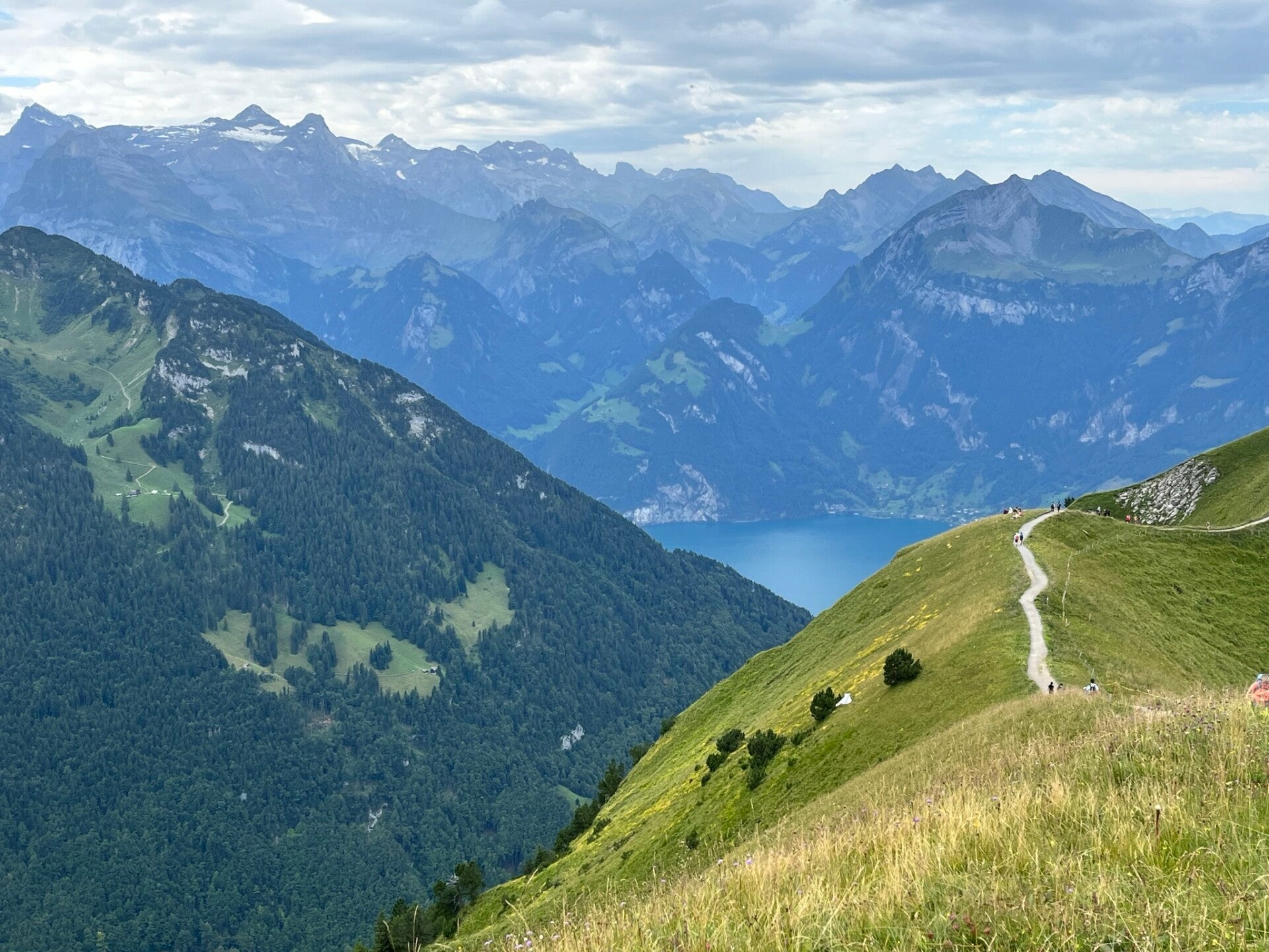
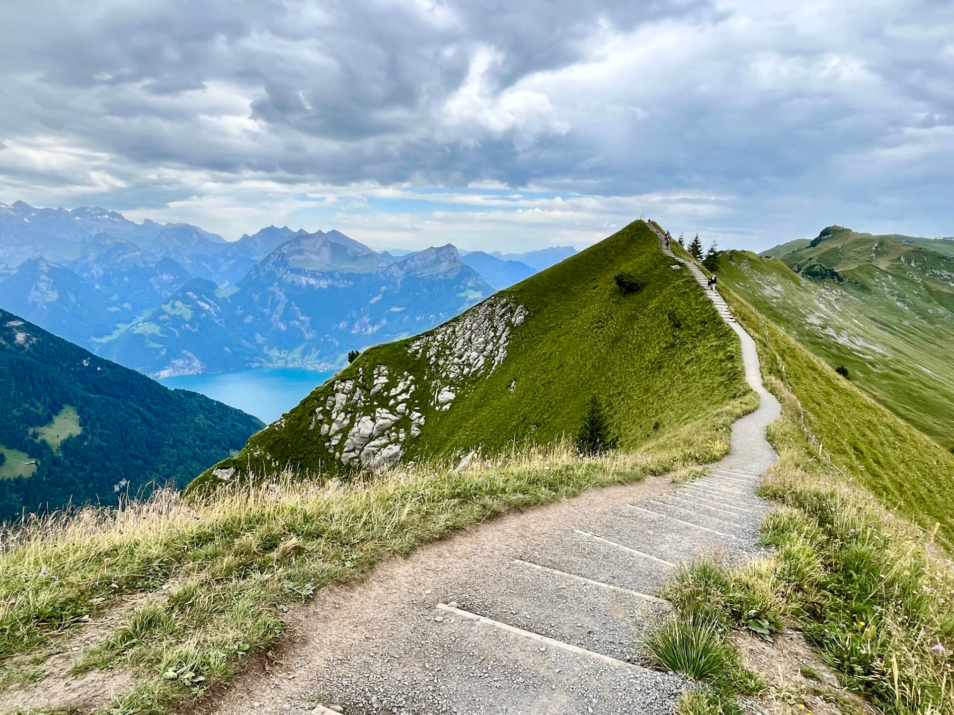
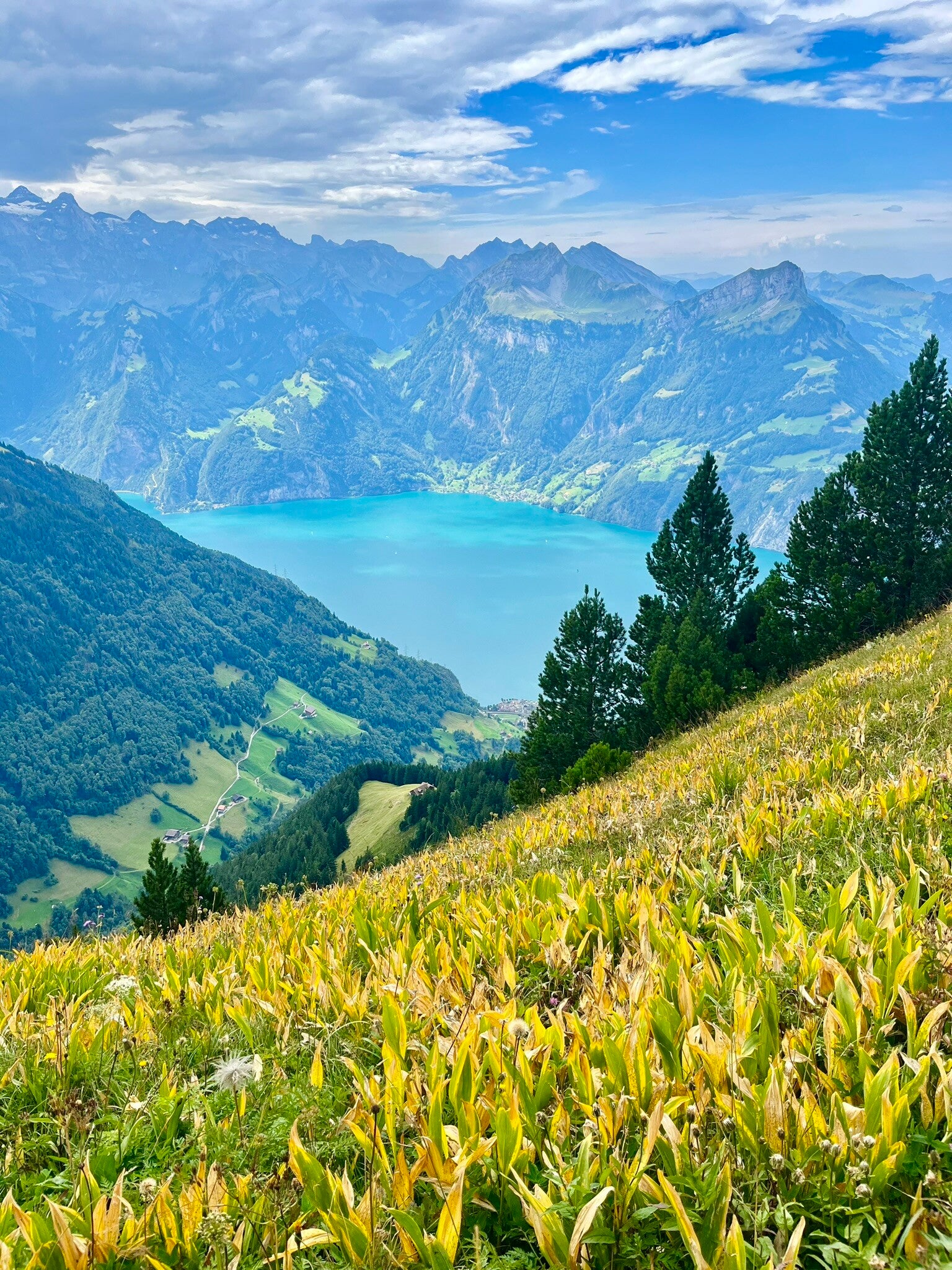
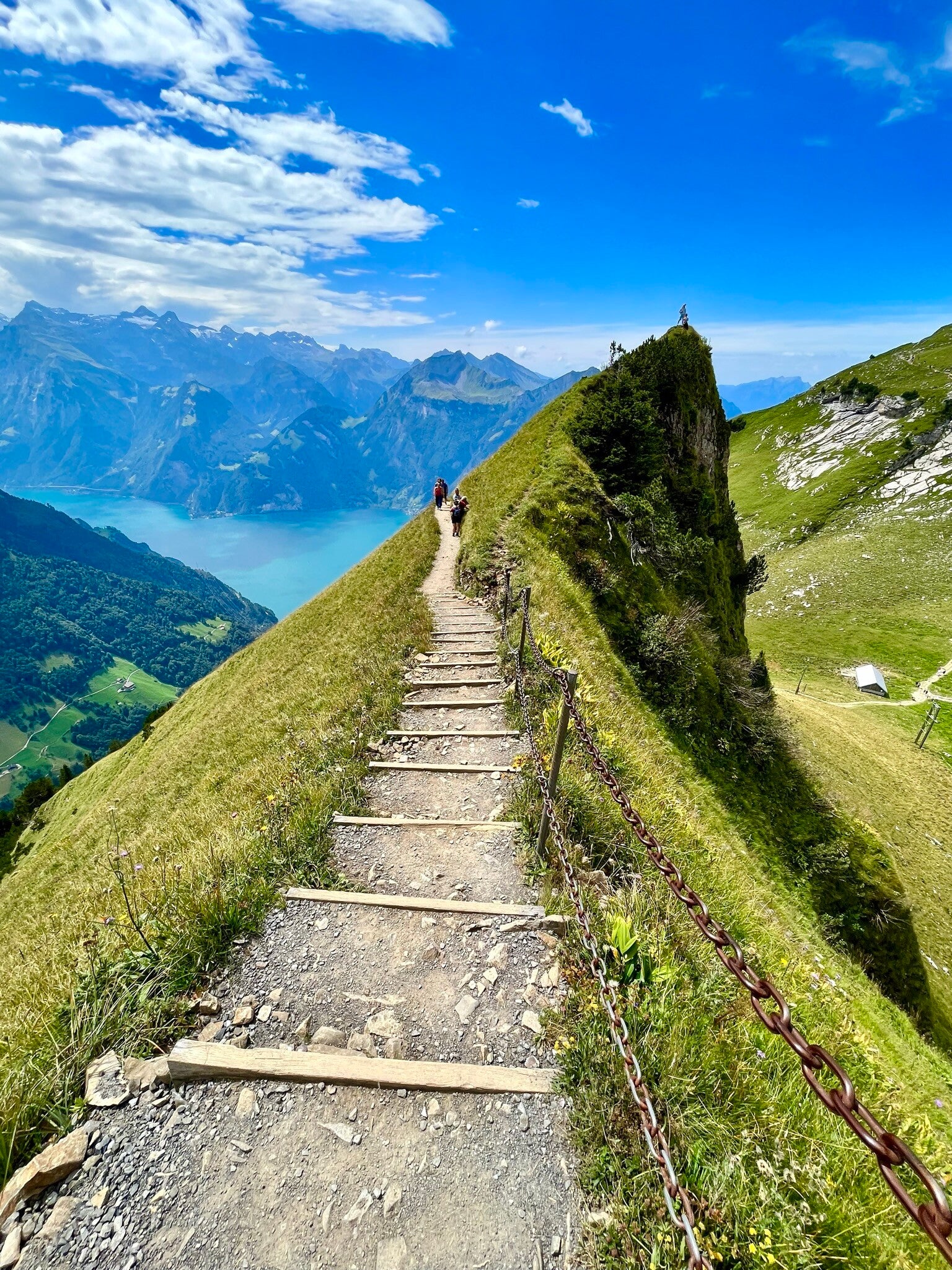
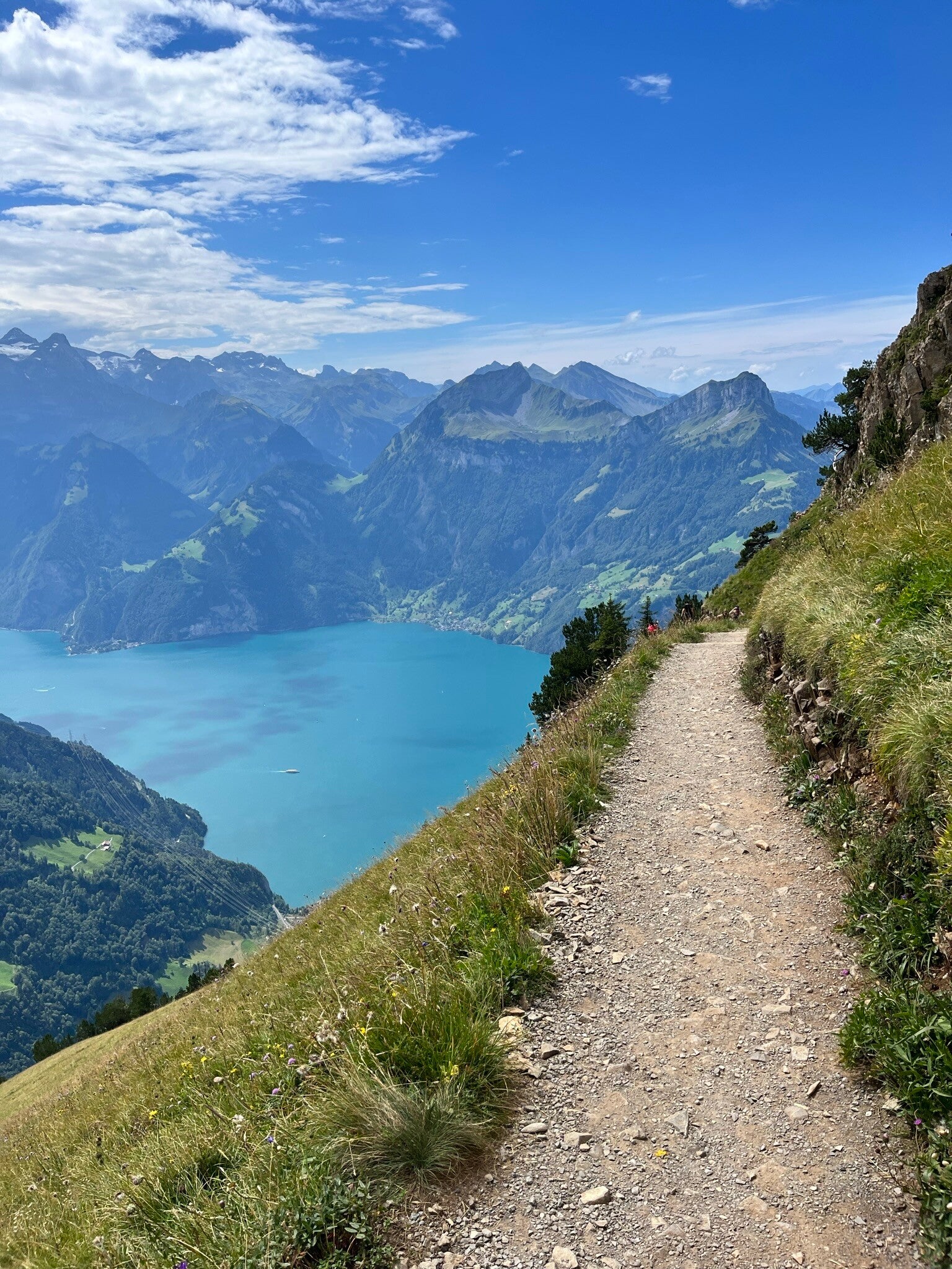
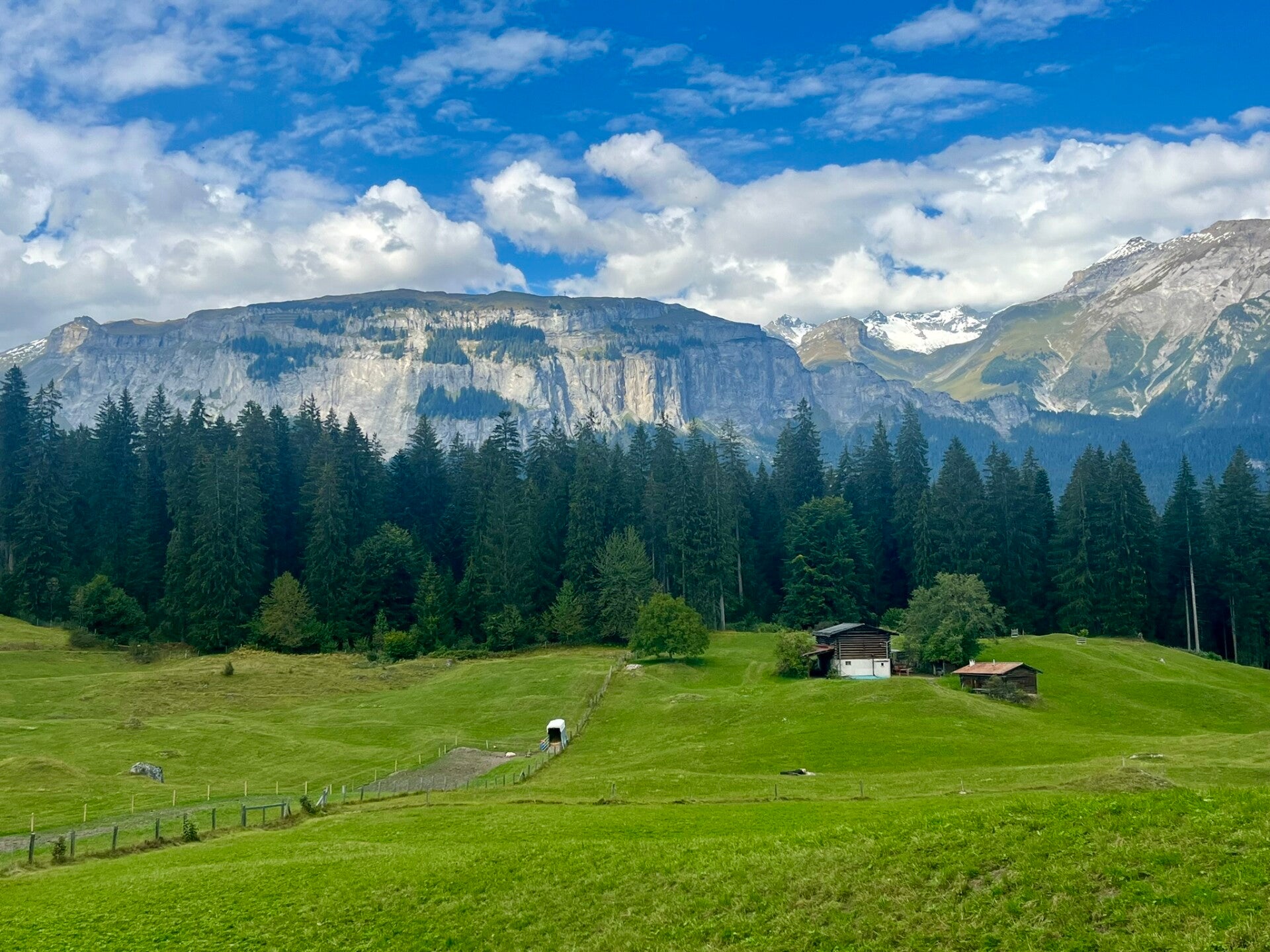
1) Stoos ridge
We’re starting strong with a breathtaking ridge walk that offers incredible views with surprisingly little effort!
The trail is just over 4 km and takes about 2 hours to complete—unless you count numerous picture stops you'll definitely take! With less than 300 meters of elevation gain, the route can be completed by almost anyone with normal fitness.
However, fitness aside, visitors should not be suffering from vertigo or strong fear of heights, as the trail has some exposed drops!
🛤️ How to Start & End
- Funicular or cable car to Stoos from Schwyz
- 20 min walk to Klingenstock chairlift
- Ride to Klingenstock summit
- Hike along the ridge to Fronalpstock
- Descend via Frontalpstock chairlift
👉 Tip: The last chairlift descent is around 17:30 during the summer season—but always double-check the timetable on the day of your visit!
6. Walk 5–10 minutes to return to Stoos station
7. Go back down via funicular or cable car
🔗 Trail details & map: Stoos Ridge walk trail
✅ Quick Tips
- Start early, as it is an extremely popular hike, so it's likely to be crowded later in the day
- Best season: June to October, when the trail is fully open and safe.
Just look at those 360° panoramas over Lake Lucerne and the surrounding alpine peaks—it’s pure Swiss magic!
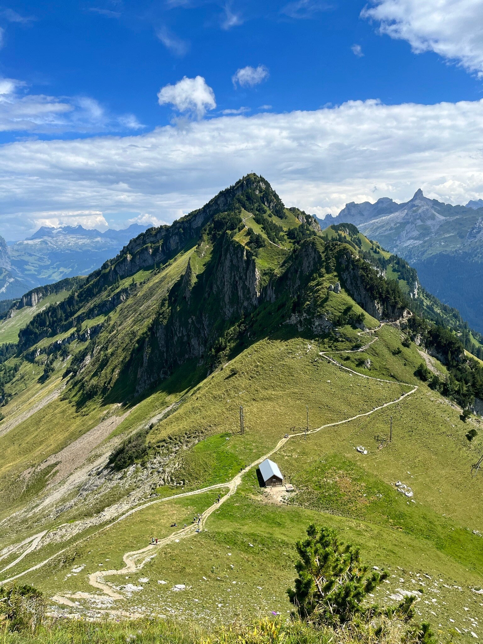
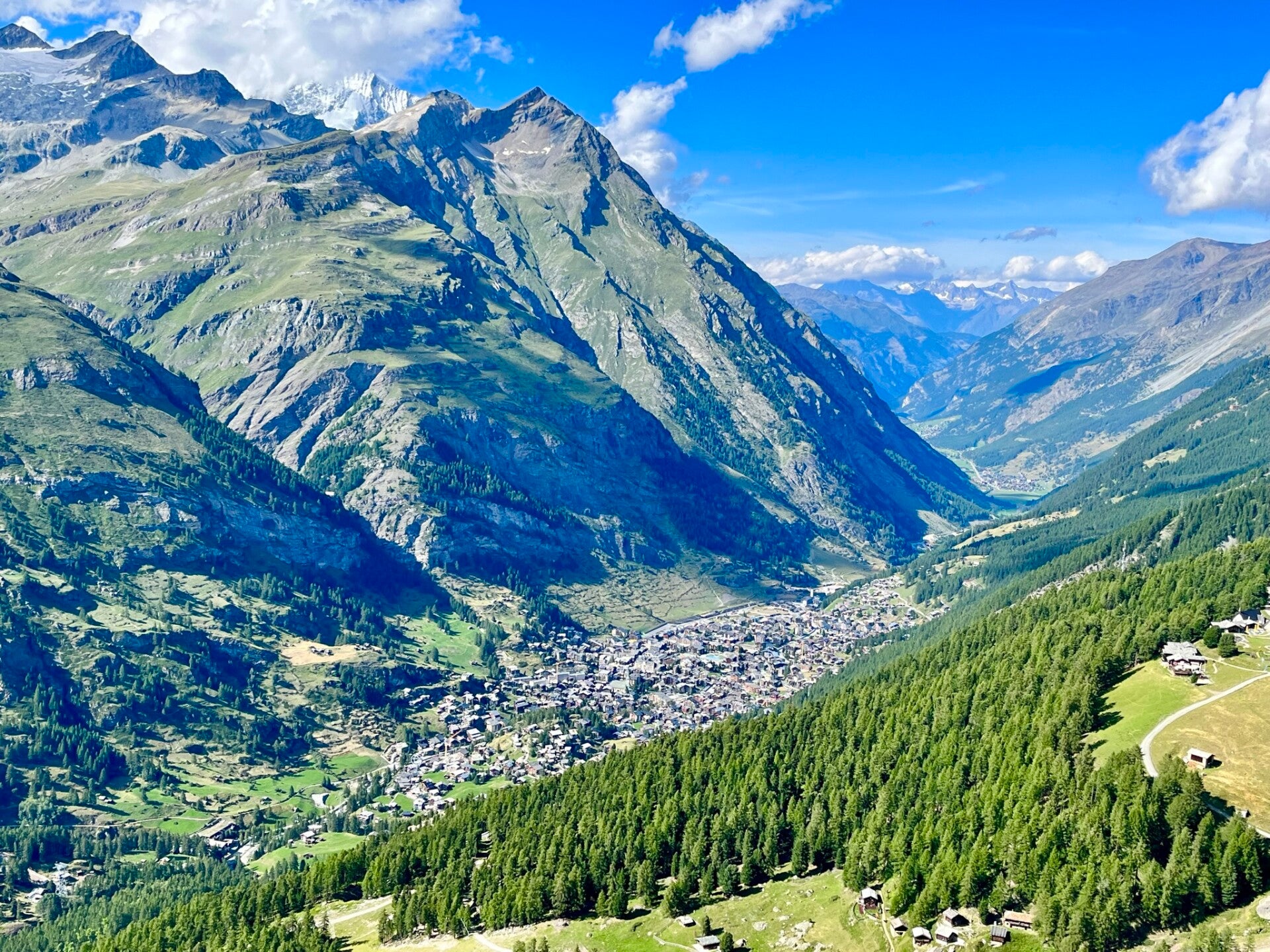
2) Grindelwald
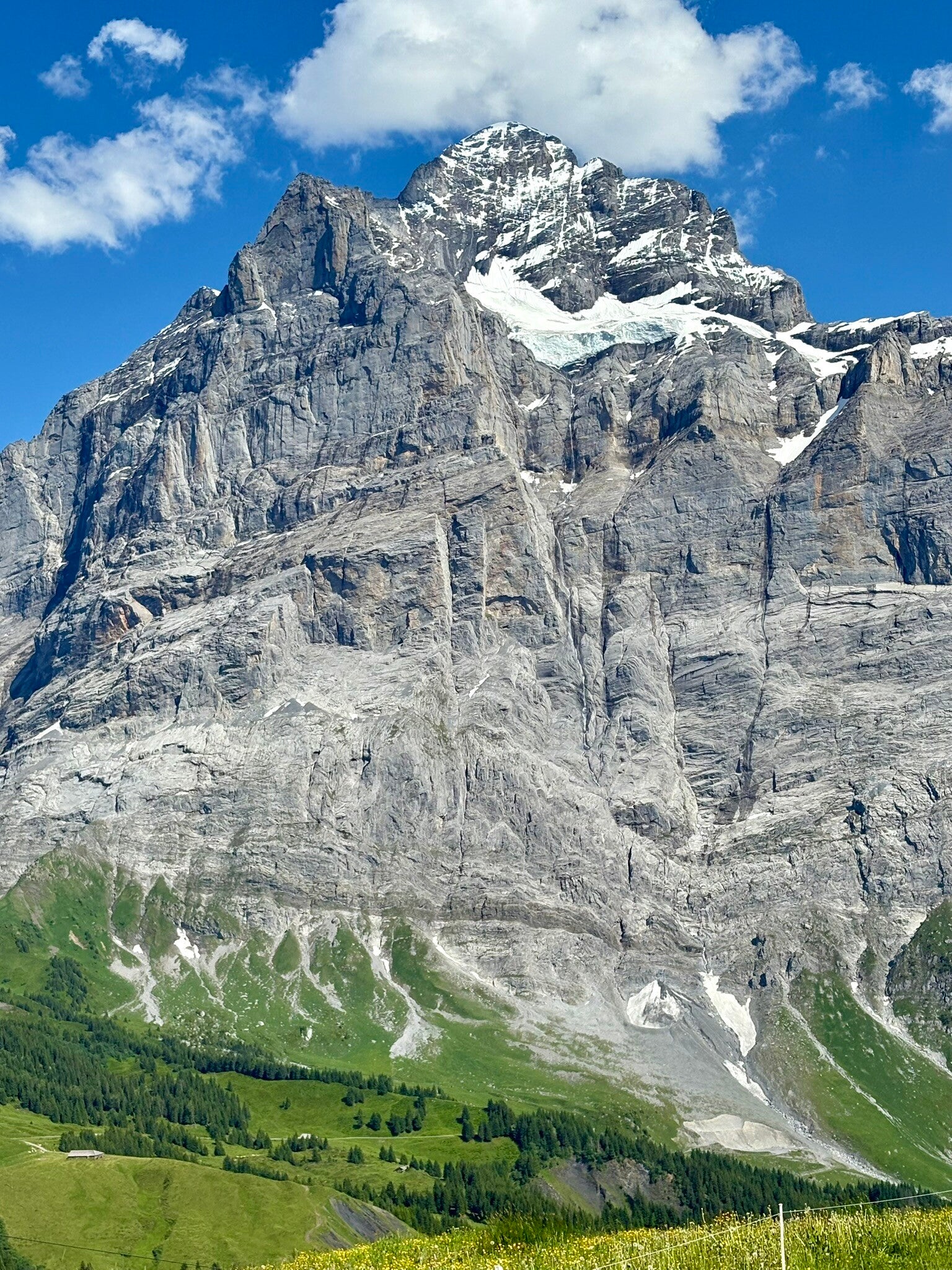
Another all-time Swiss favorite is Grindelwald. The best part? This route comes with a bonus—you get majestic alpine views without the heavy crowds!
How is that possible? While most tourists flock to the famous First Cliff Walk (the elevated walkway bolted to the side of the mountain), the surrounding trails are surprisingly quiet, and there are plenty of incredible options to choose from.
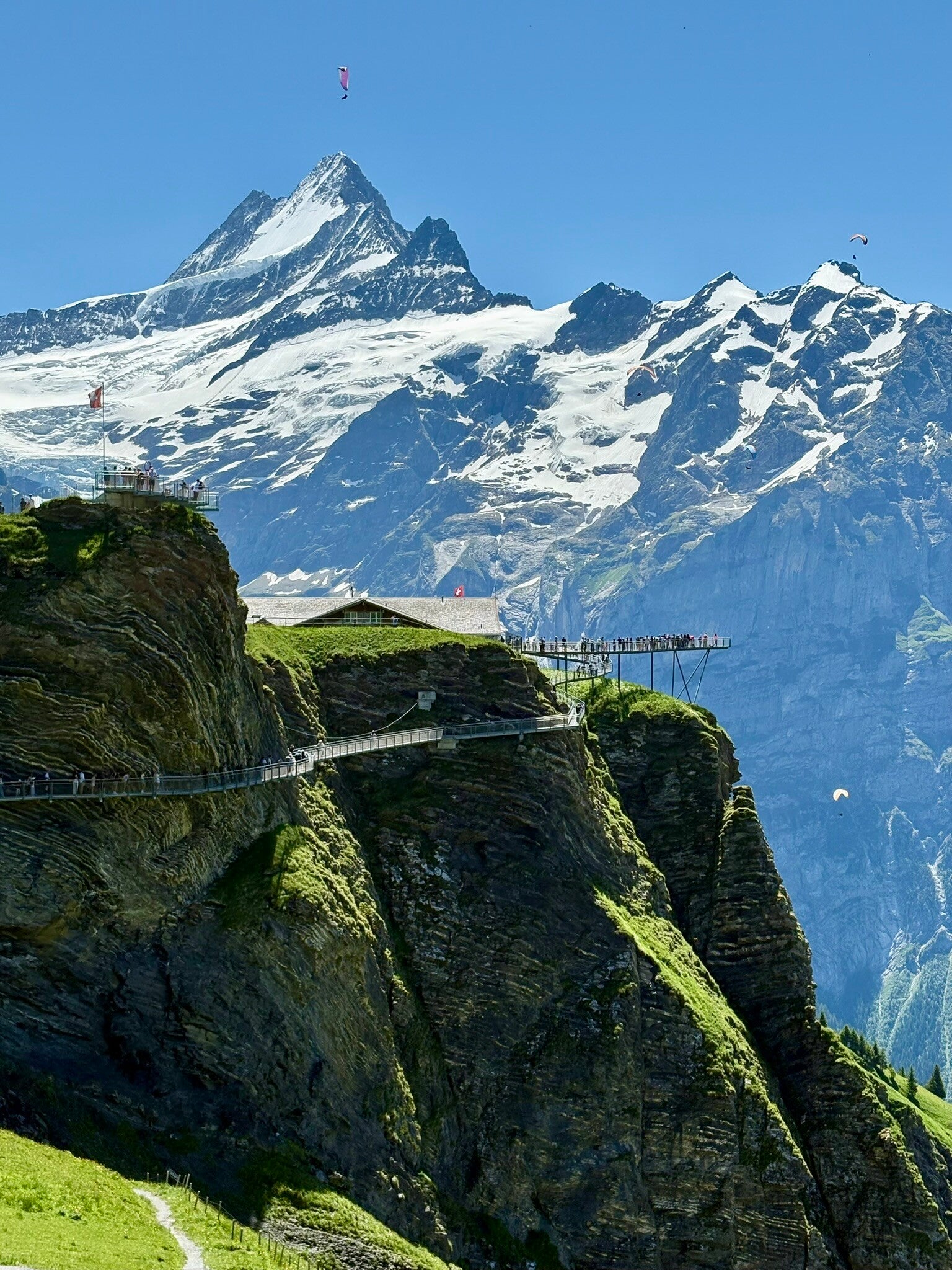
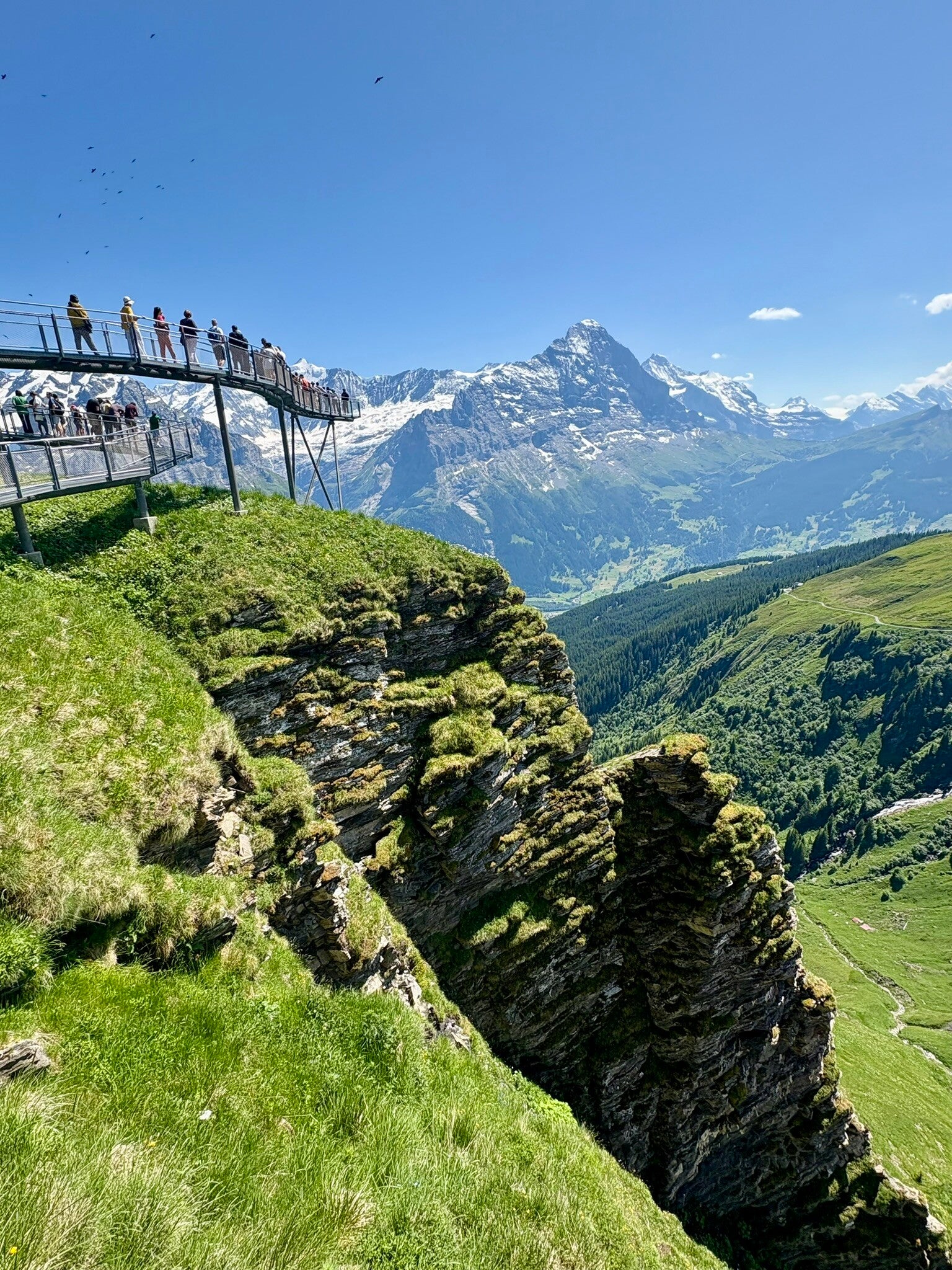
The Tourist Hotspot: First Cliff Walk
When you step off the scenic gondola at Grindelwald First Station, the first thing you'll see is the First Cliff Walk. Yes, it’s touristy—but there’s a reason it’s so popular.
Perched at 2,100 meters above sea level, this narrow steel walkway and glass-floored viewing platform extend dramatically over the edge, offering panoramic views of the Bernese Alps, including the legendary Eiger peak.
⚠️ Heads-up: during the peak summer season there might be a queue to reach the end of the viewing platform.
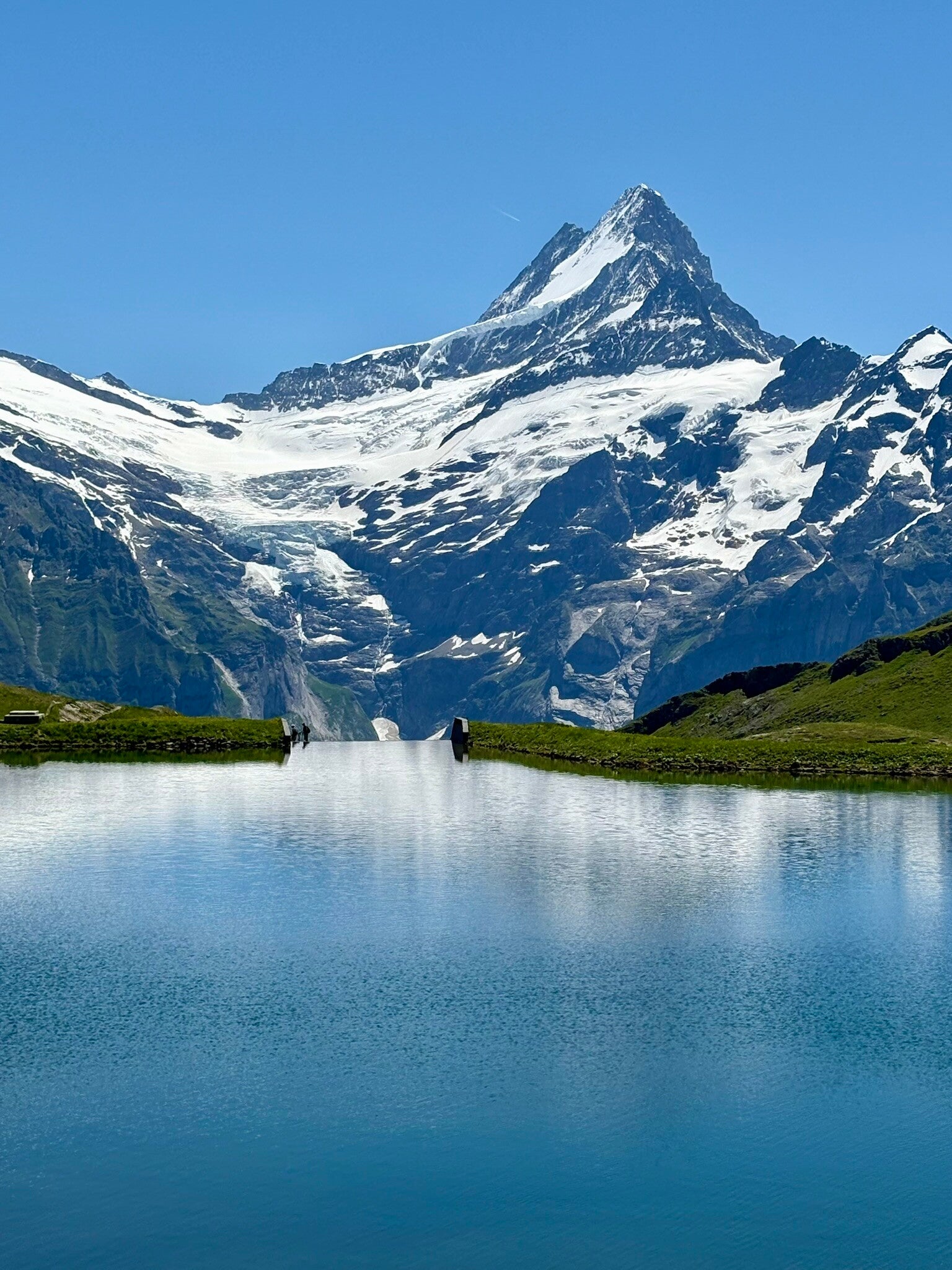
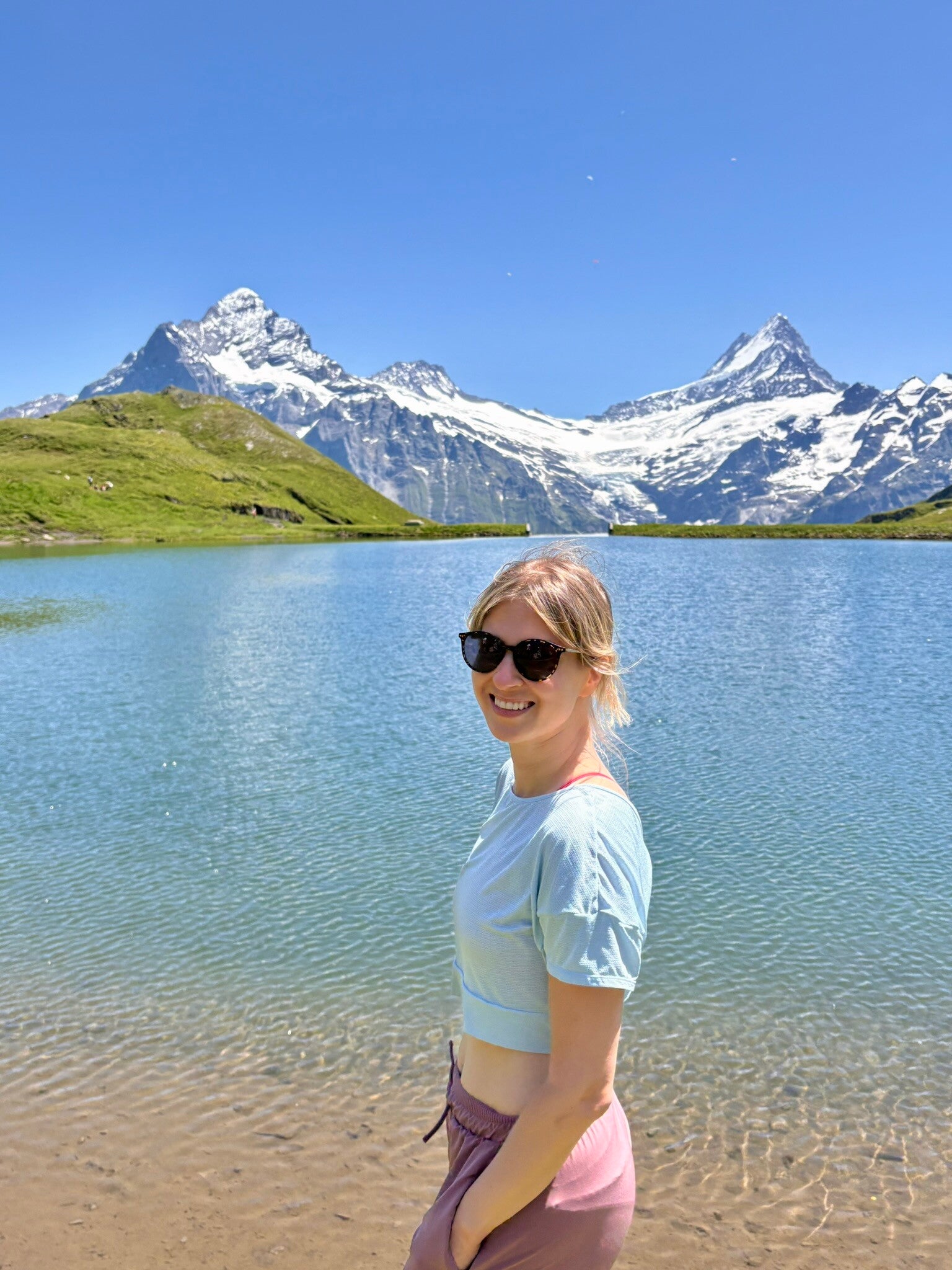
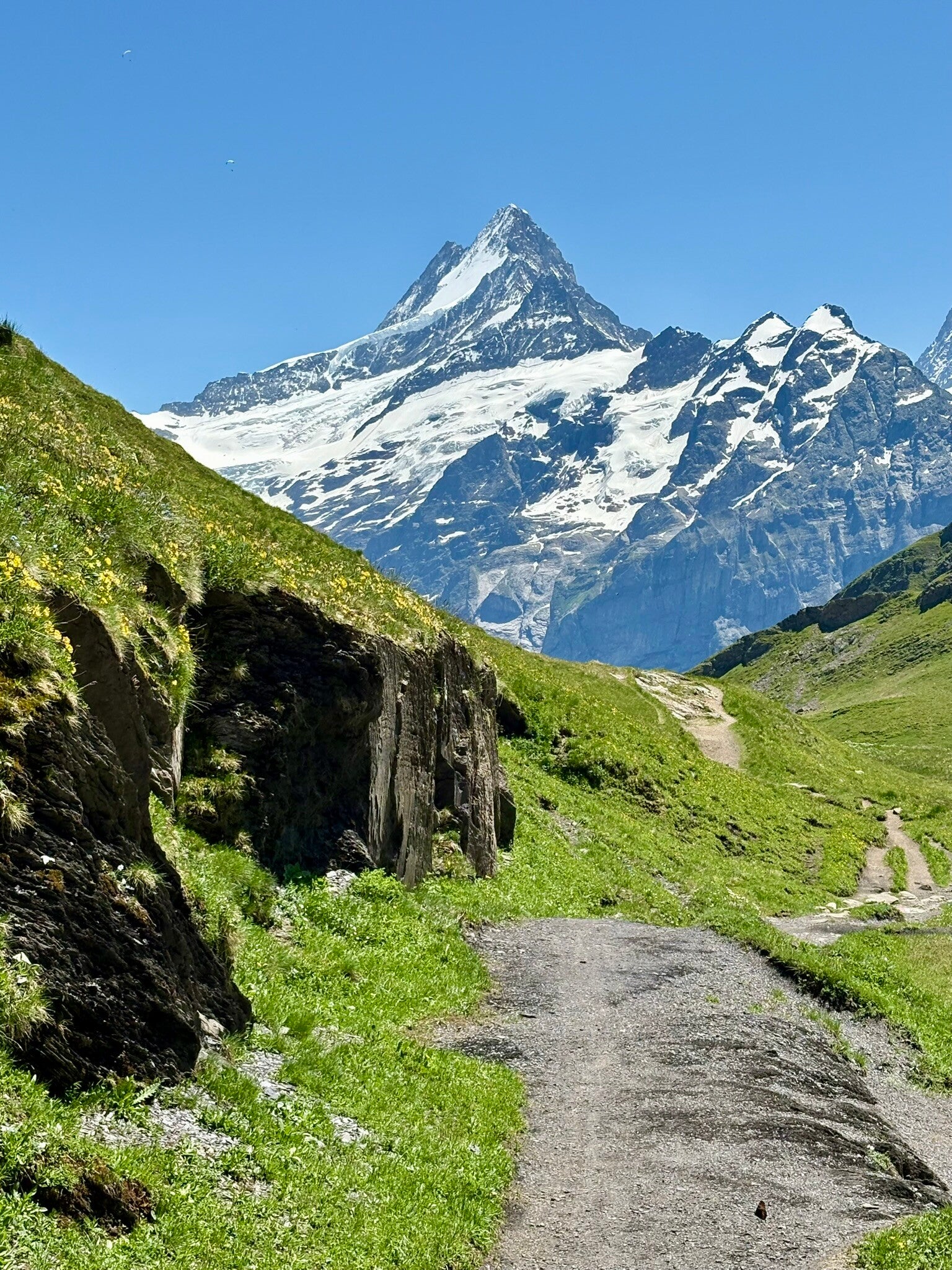
The Quieter Side of Grindelwald: Bachalpsee
Once you've soaked in the views of the Cliff walk, it’s time to escape the crowds and hit the trail to Bachalpsee Lake—an absolute postcard-perfect alpine lake.
The hike is about 6 km out and back and takes roughly 2 hours at a moderate pace. It’s slightly longer than the Stoos ridge walk but less steep. Definitely budget extra time to relax by the lake, enjoy the stunning scenery, or even take a (chilly!) dip if you’re feeling brave.
🔗 Trail details & map: First-Bachalpsee trail
🛤️ How to Start & End
- Take the First gondola from Grindelwald village (~25 min ride).
- Return via the same route back to First.
👉 Tip: The last gondola descent is at 18:00 during the summer season—but always double-check the timetable on the day of your visit!
Alternative Hikes
- First to Grindelwald Village: If you’re not tired yet, hike downhill all the way back to the village. While no stamina is needed, make sure that your knees are up to the task! First-Grindelwald trail
- Marmot Trail: For wildlife lovers, this trail offers a chance to spot adorable marmots (those chubby alpine rodents). They’re not shy, but usually spotted from a distance, so binoculars might be a good idea! Marmot trail
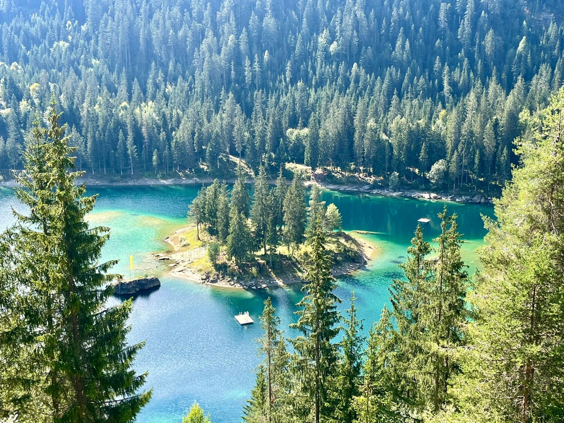
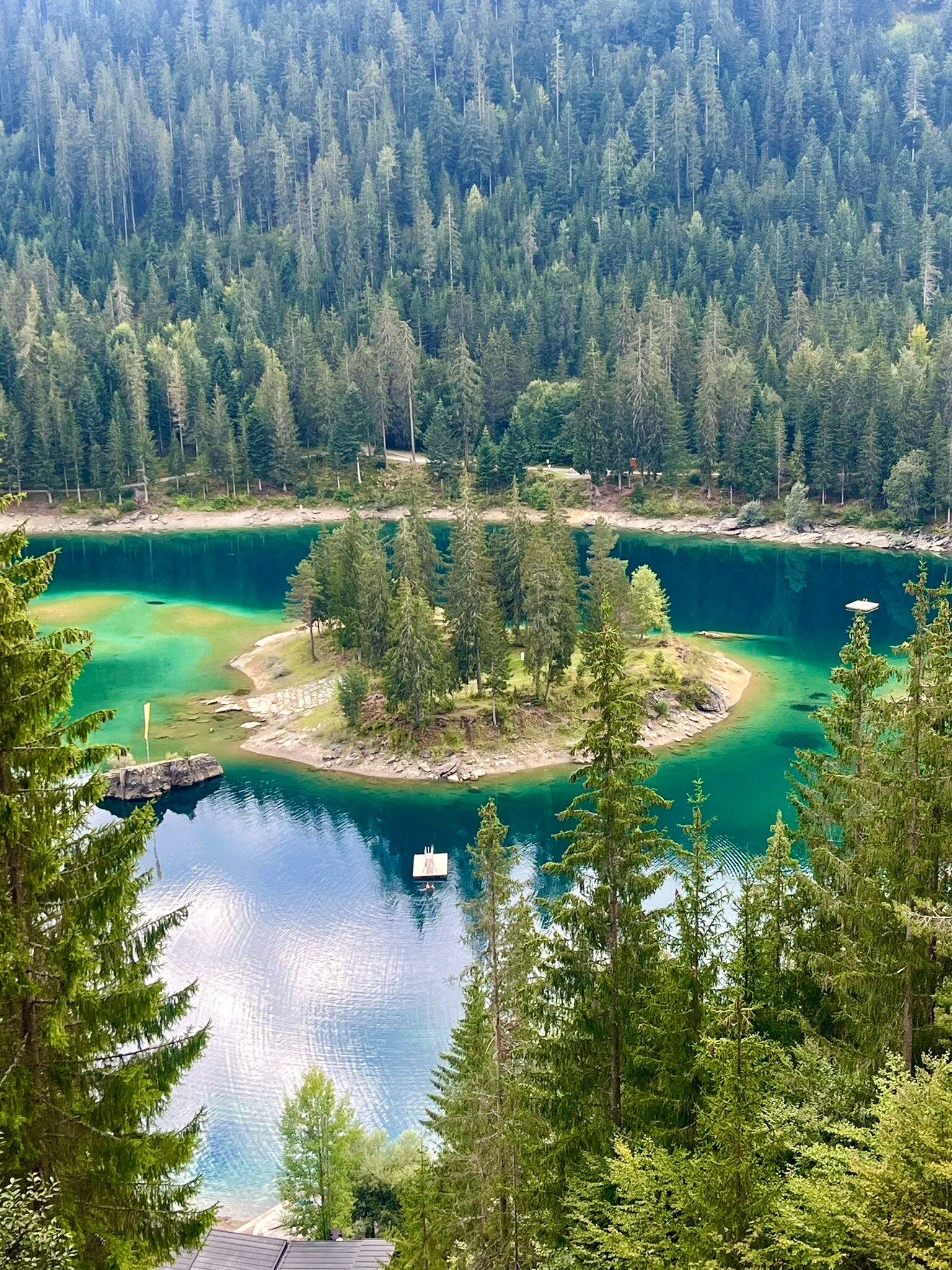
3) Caumasee
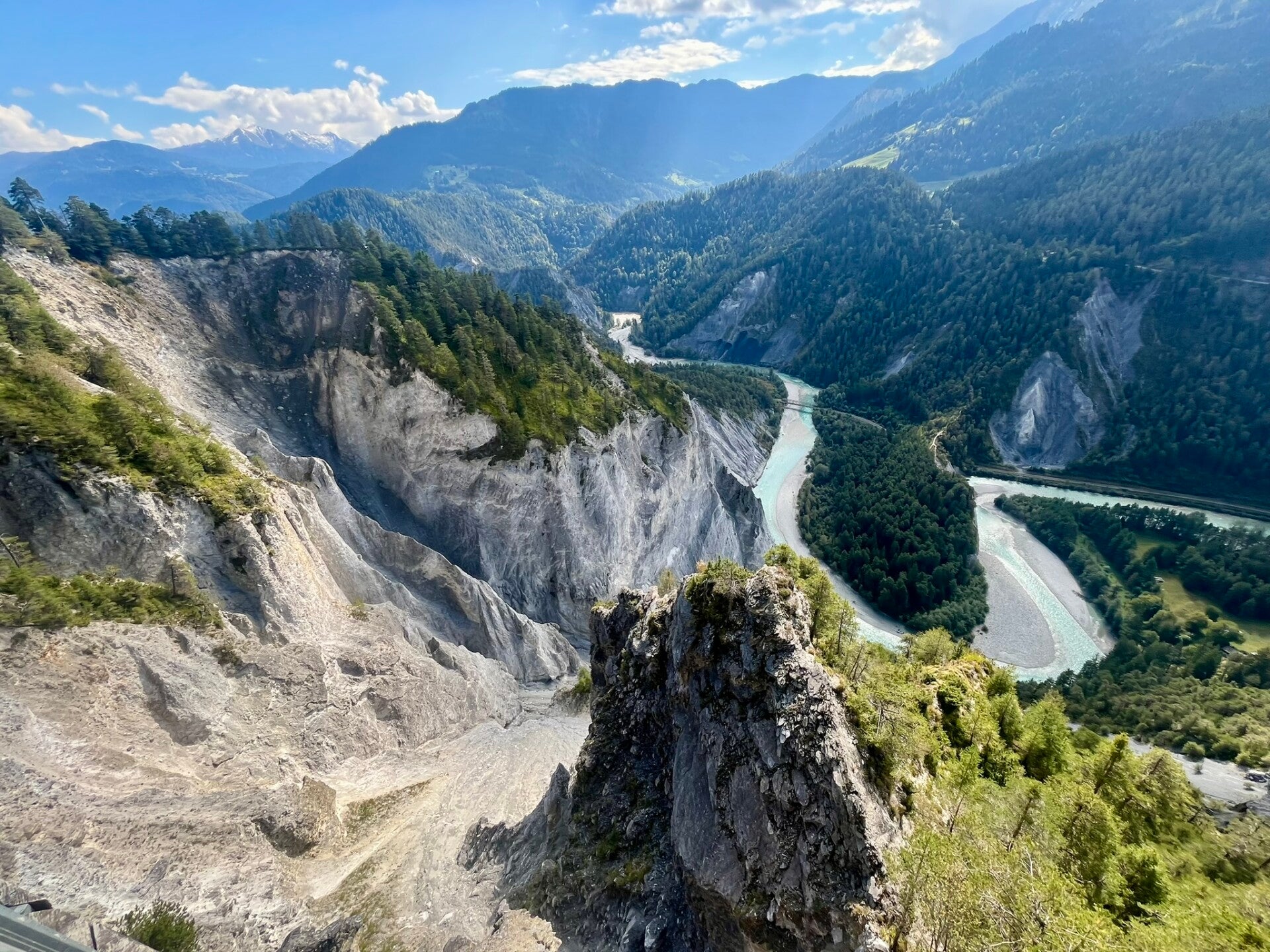
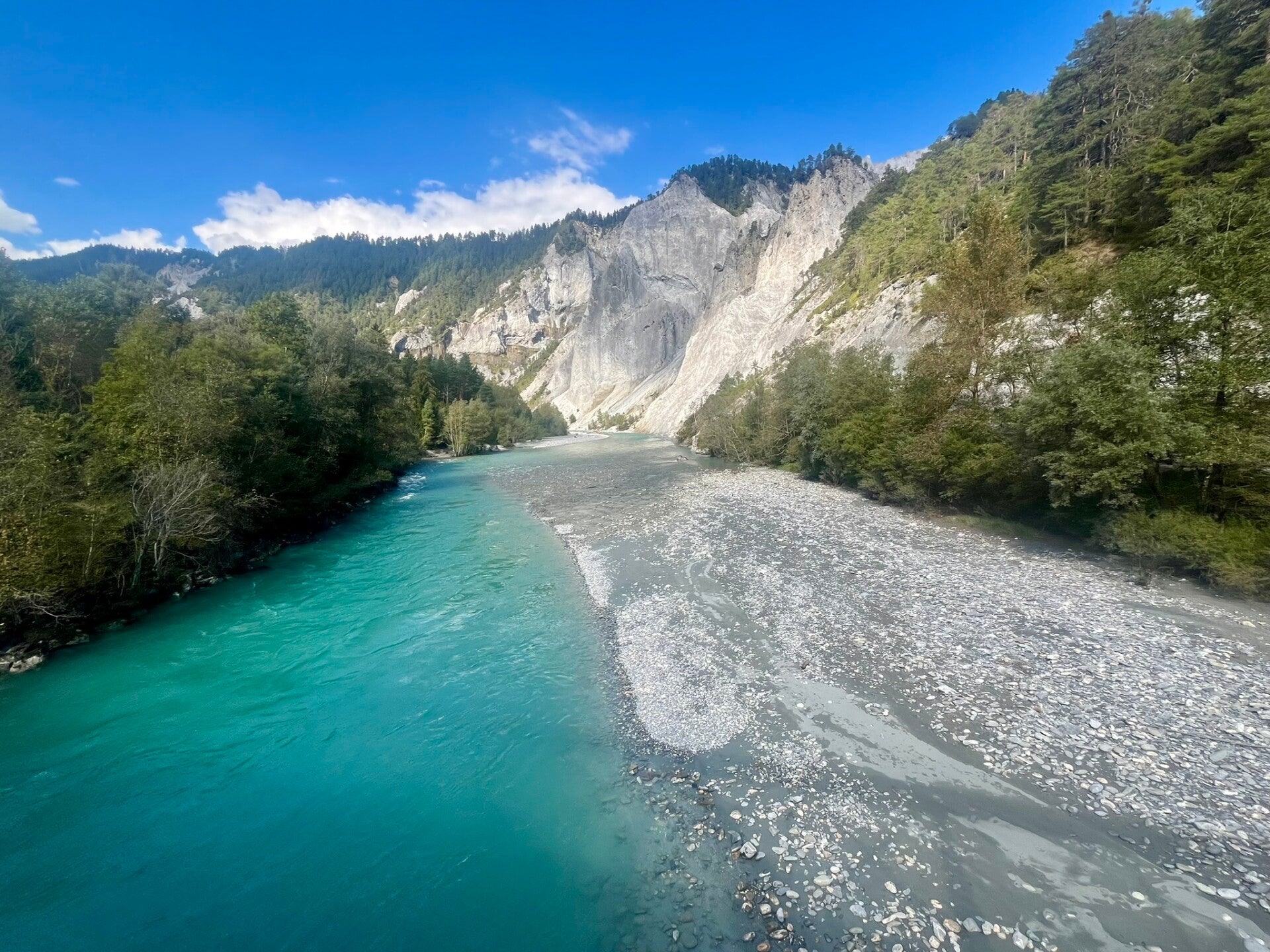
Caumasee (Cauma lake) is another easy-going route that rewards you with not one, but two stunning views! It connects two standout highlights: the turquoise Caumasee and the dramatic Rhine Gorge, the "Swiss Grand Canyon".
The hike is about 7 km round trip, with mild elevation gain, taking roughly 2 hours at a moderate pace. As always, make sure to budget extra time to really soak in the views.
Almost right at the start of the trail, you’ll be greeted by Caumasee’s incredibly blue—almost tropical-looking—waters. The striking color comes from glacial meltwater mixed with mineral-rich underground springs. Adding to the charm, Caumasee features a small natural island in the middle, making the scene even more unique.
👉 Tip: Caumasee is also swimmable and, unlike many other Swiss mountain lakes, it can warm up to a pleasant temperature in summer. There’s a designated swimming area with paid entry for those who want to take a dip.
Next major viewpoint is halfway through hike - Il Spir, an observation platform offering a 180° view over the Rhine gorge, framed by rock cliffs and alpine forest. The gorge itslef was formed over 10,000 years ago by a massive rockslide in the Flims region, and today it's a hotspot for spectacular views and activities like rafting and kayaking.
🛤️ How to Start & End
- Starting point: Flims Waldhaus (easily reached by PostBus from Chur or by car)
- Loop back to Flims Waldhaus
👉 Tip: No gondolas to catch on this one, and buses to Chur run late—so take your time and enjoy the day!
🔗 Trail details & map: Caumasee & Rhine Gorge Trail

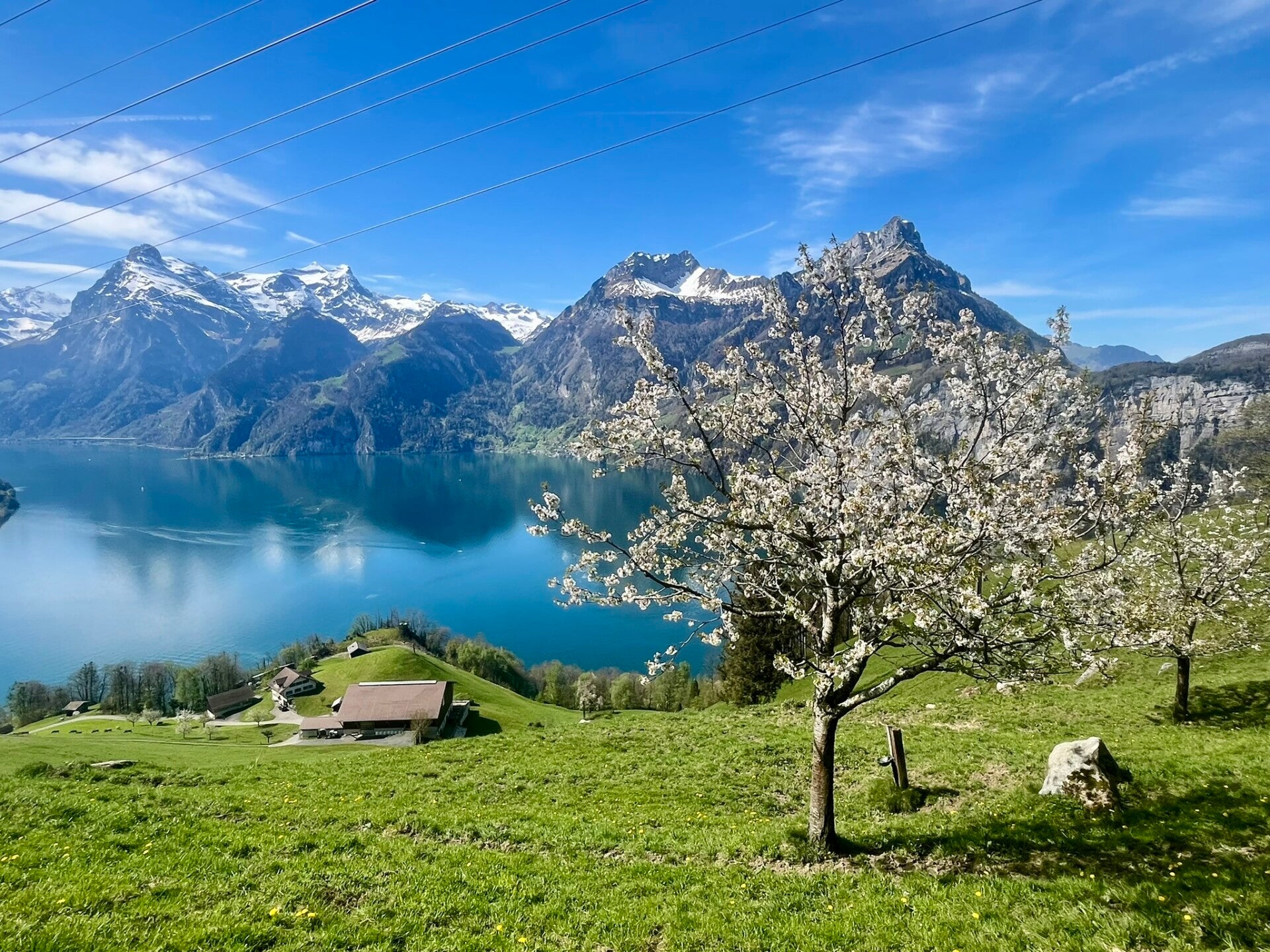
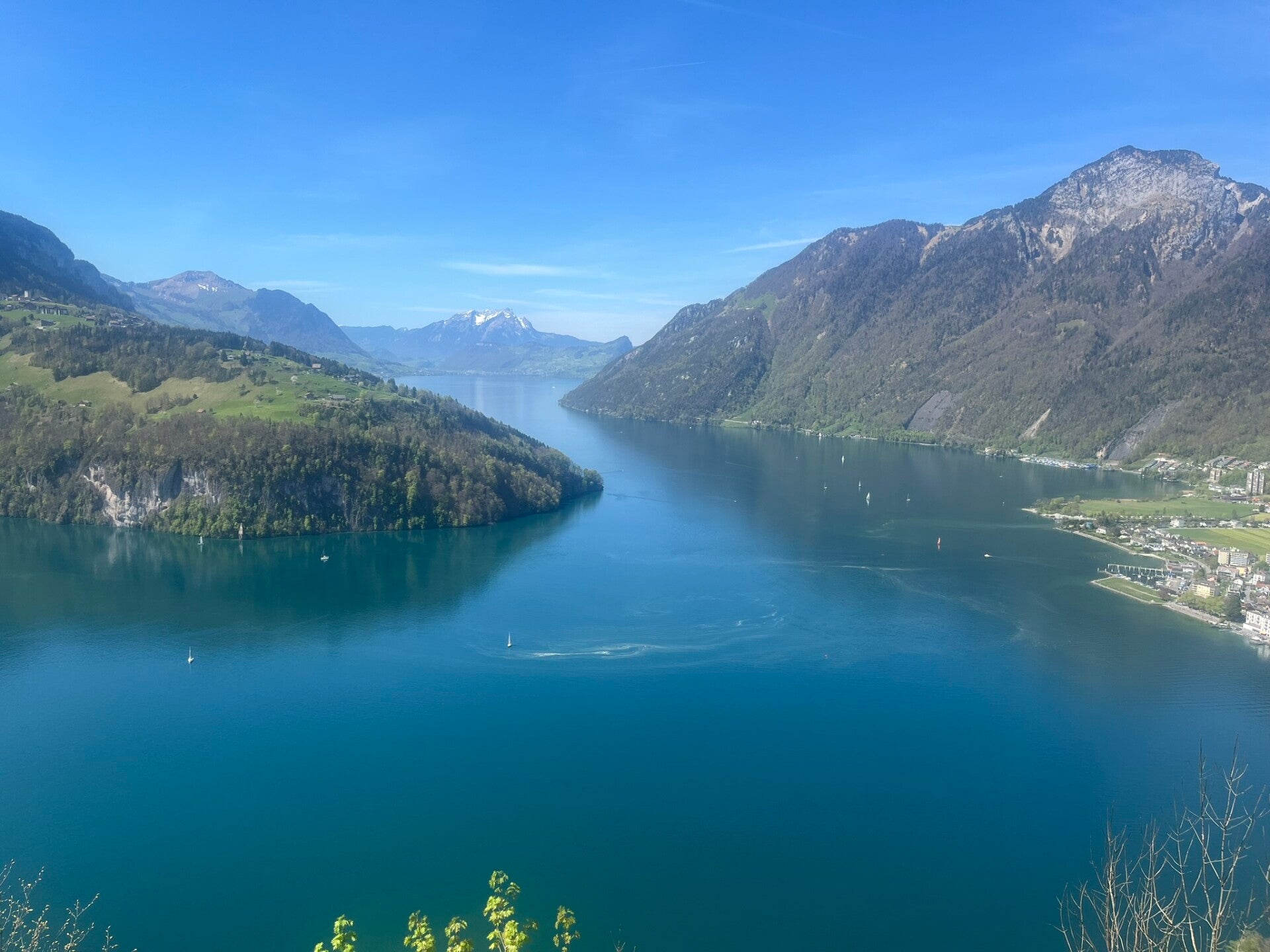
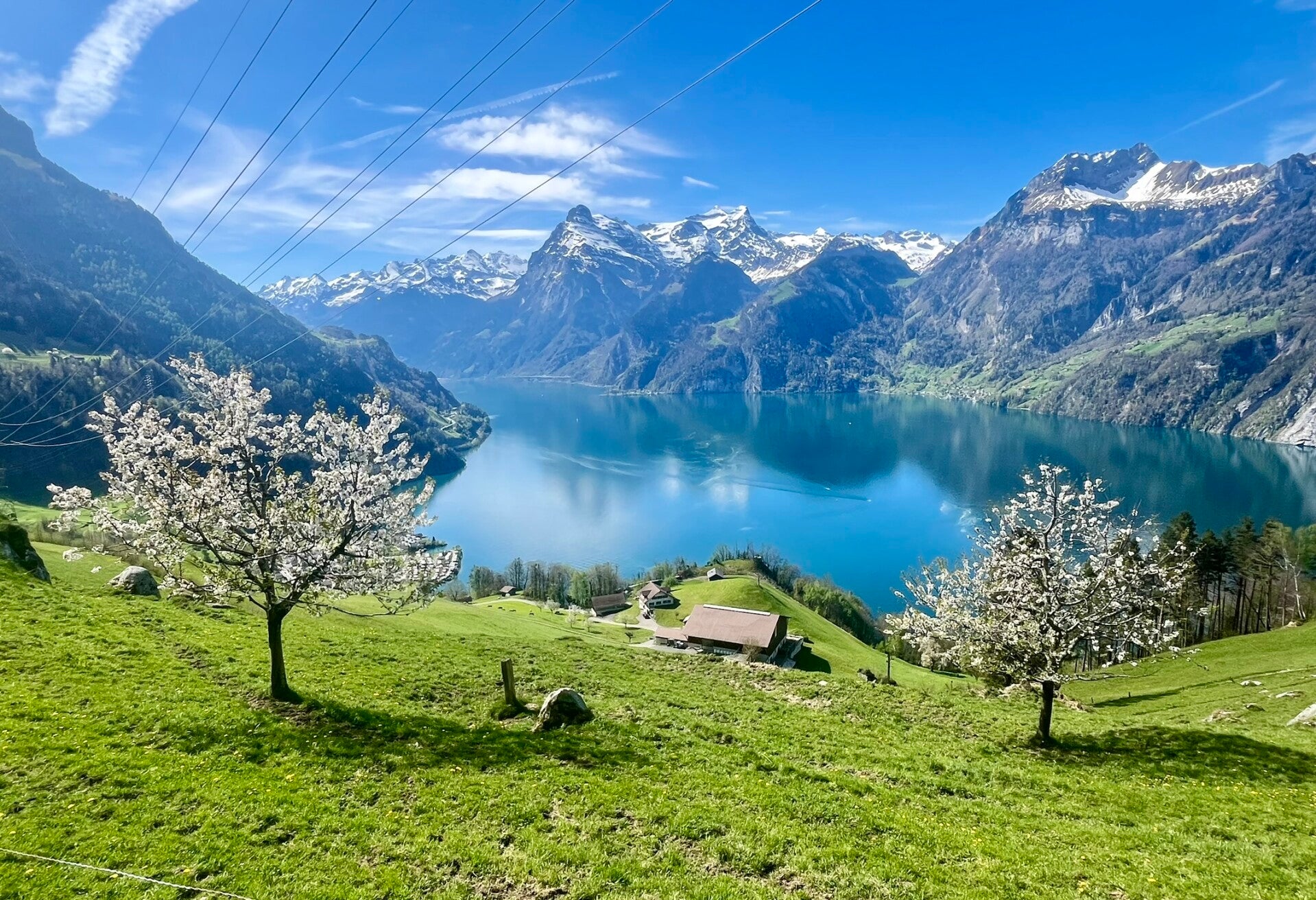
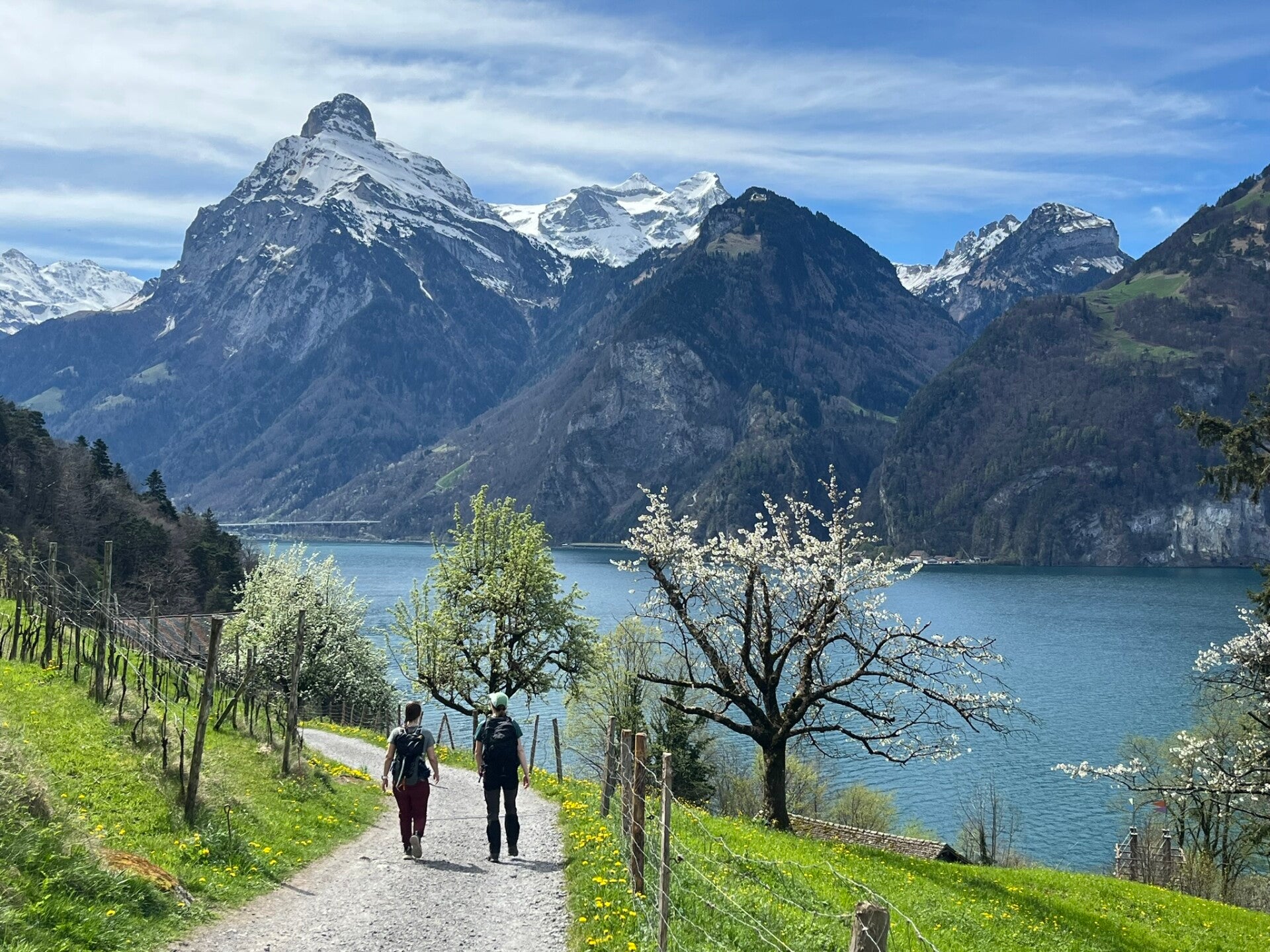
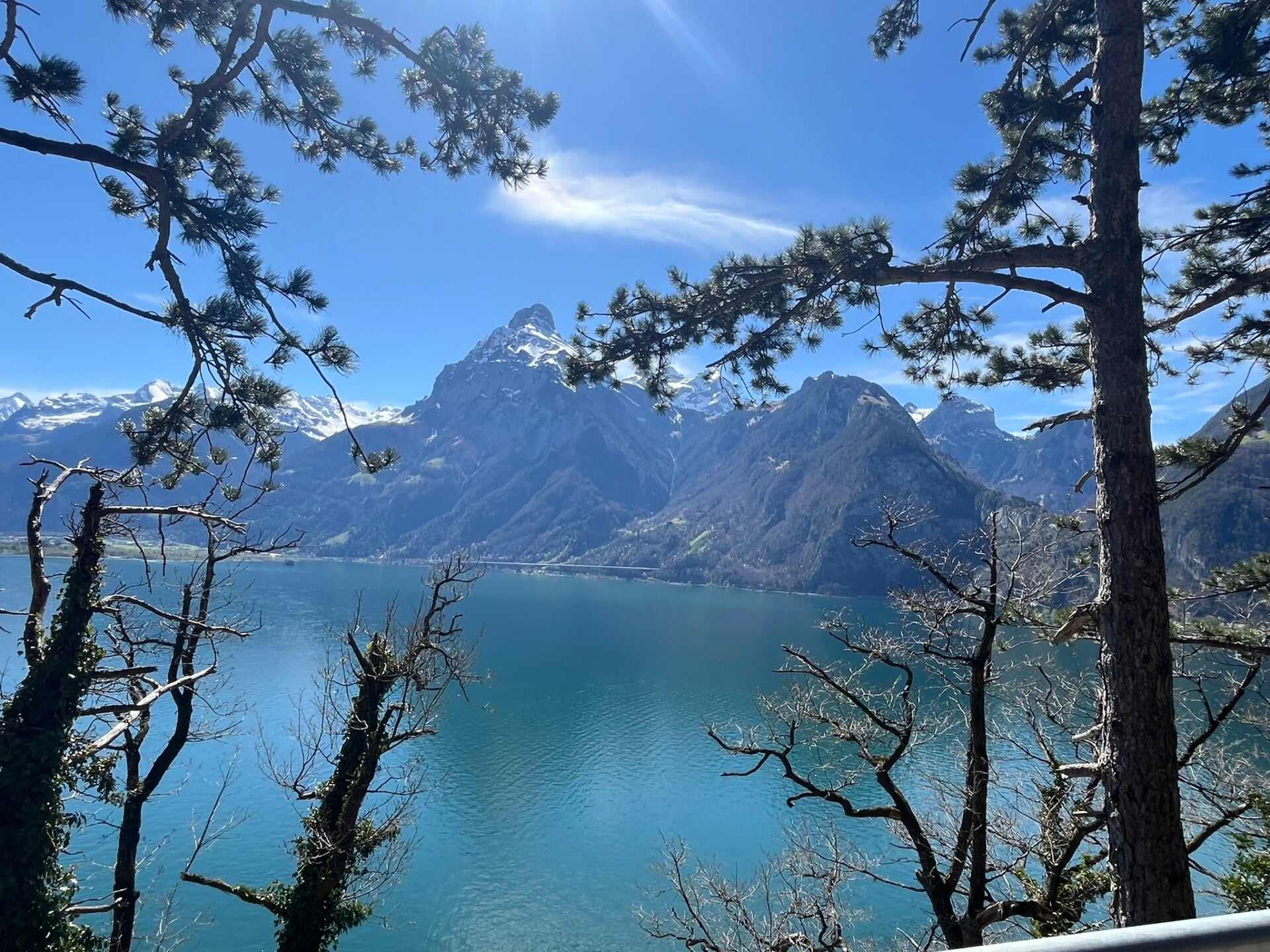
4) Lake Lucerne via Sisikon
It would be a sin not to include a hike along Lake Lucerne (Vierwaldstättersee) on this list. With over 100 km of shoreline, the lake offers countless trails and strolls. I'd like to recommend one particular hike that really deliveres when it comes to views!
This point-to-point hike covers about 5.6 km with roughly 406 m of ascent, taking around 2 hours at a moderate pace. While the elevation gain is a bit higher than some of the other hikes mentioned, it’s still very doable and well worth the effort.
The route is part of Switzerland’s historicWeg der Schweiz, a lakeside trail known for its breathtaking scenery. You’ll start in the quiet village of Sisikon, right on the lake, and ascend steadily through shaded forest trails. At the top, you’ll be rewarded with panoramic views over the Rütli Meadow and the lake itself. From there, the route descends gently toward Morschach, another scenic alpine village.
Best thing of all? There are no crowds, so you do get to enjoy the views AND connect with the nature.
🛤️ How to Start & End
- Start: 🚉 Sisikon station — easily reachable by train or boat on Lake Lucerne.
👉 Tip: If you're up for it, take the boat from Brunnen to Sisikon for a scenic ride across the lake. It's a beautiful start to your hike! Check the Timetable - End: 🏞️ Morschach — from here, you can catch a bus to Brunnen or a train back to Sisikon or Flüelen.
🔗 Trail details & map: Caumasee & Rhine Gorge Trail
👉 Bonus tip: Traveling with kids or want to relax? Morschach is home to the Swiss Holiday Park, one of Switzerland’s largest family resorts—perfect for extending your stay with wellness or fun activities.

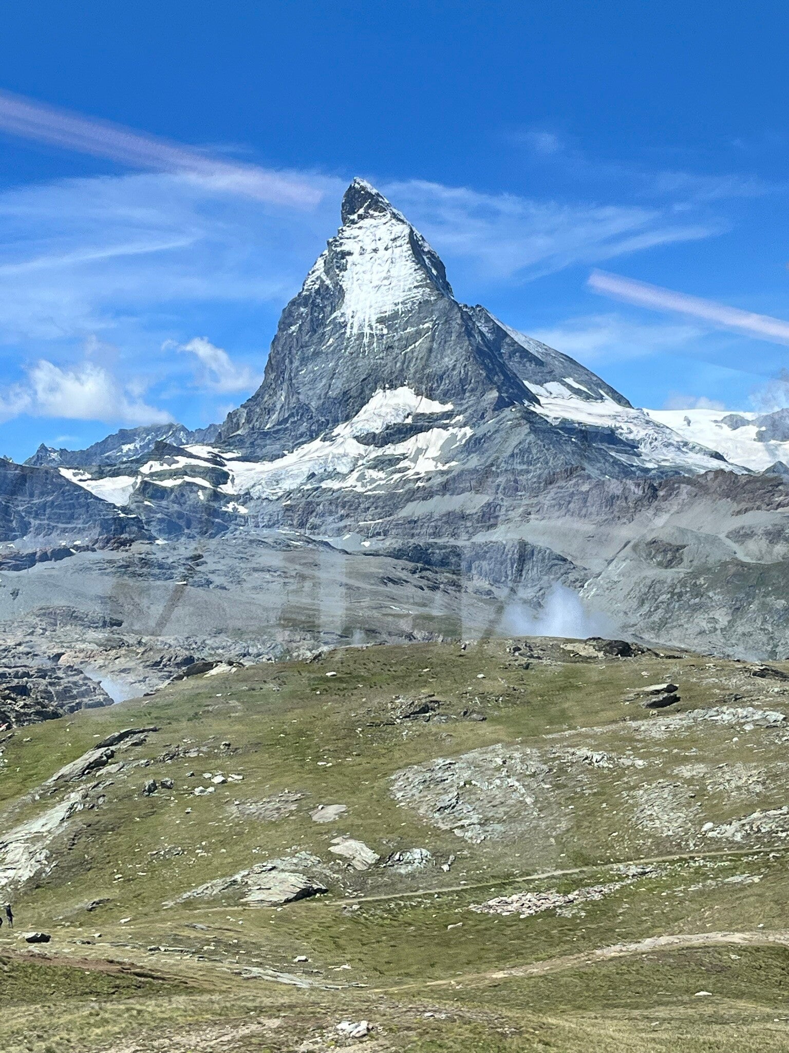
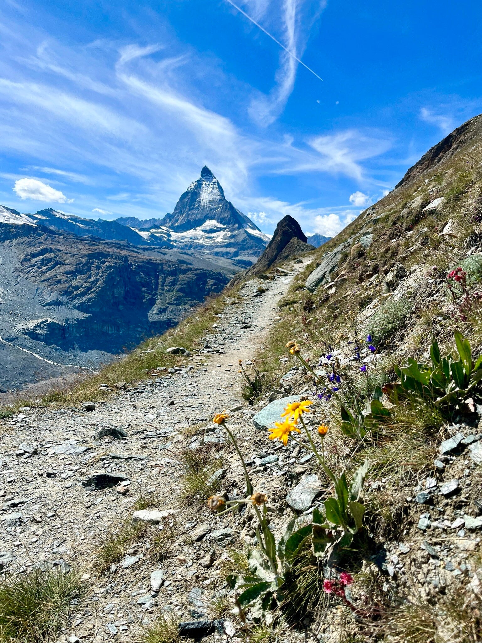
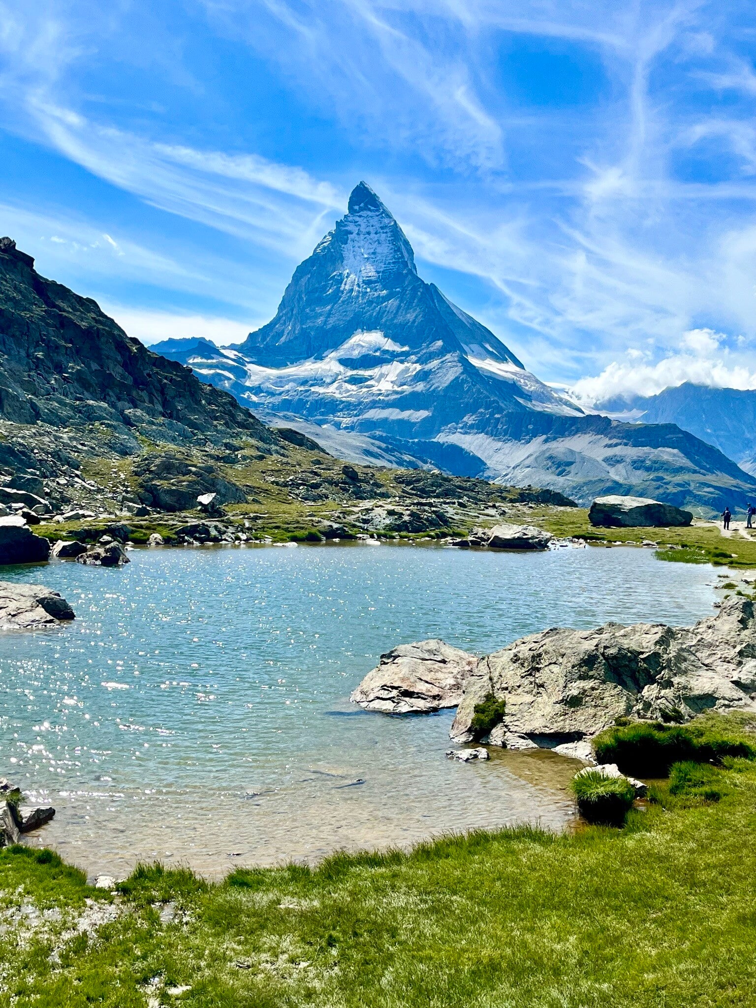
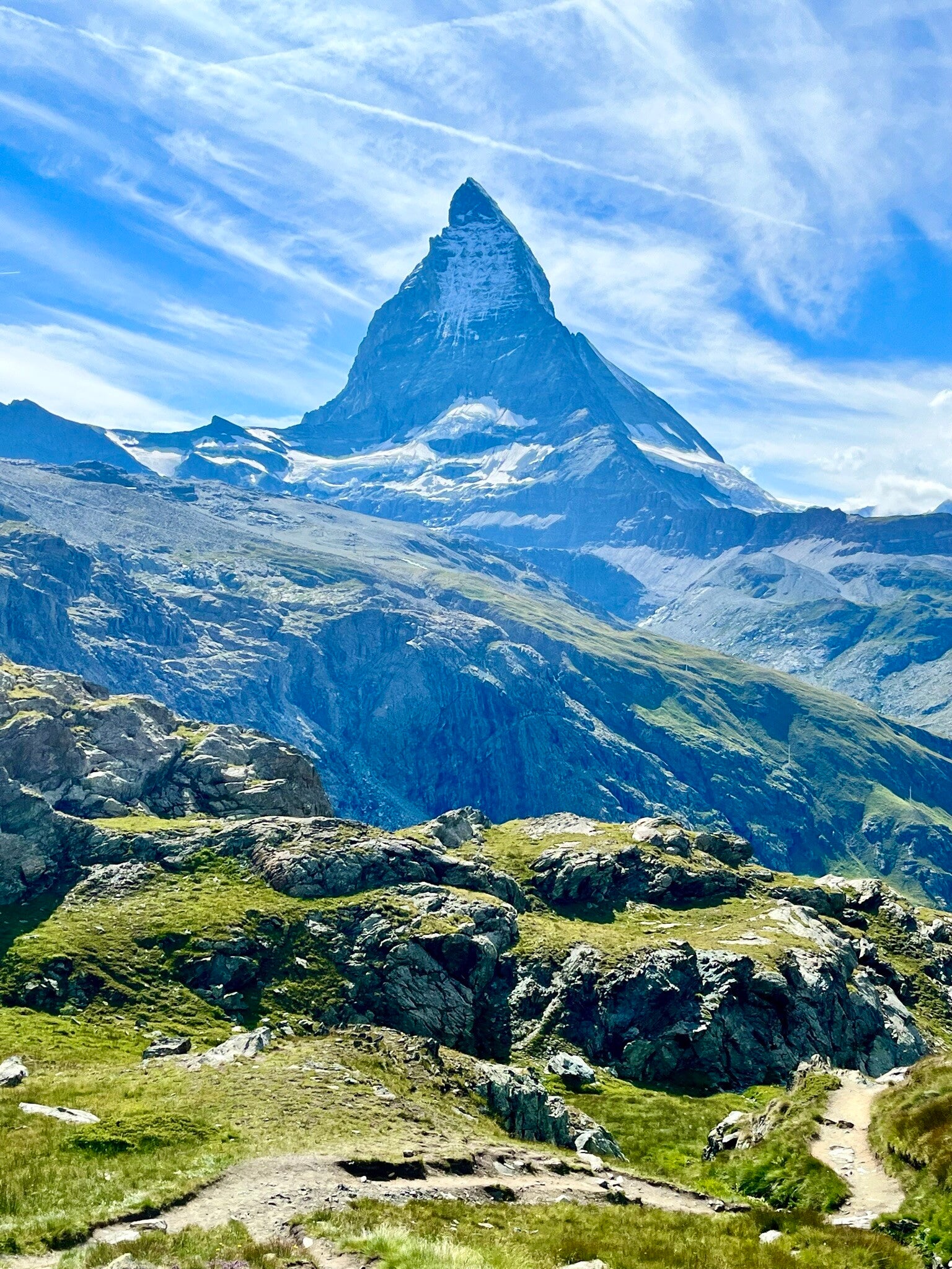
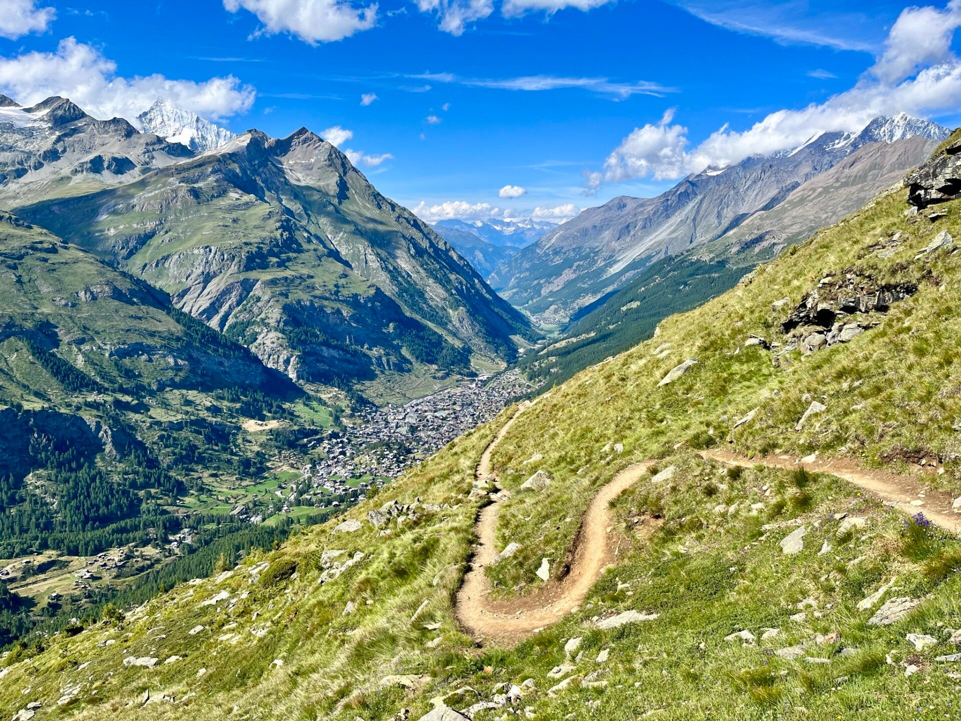
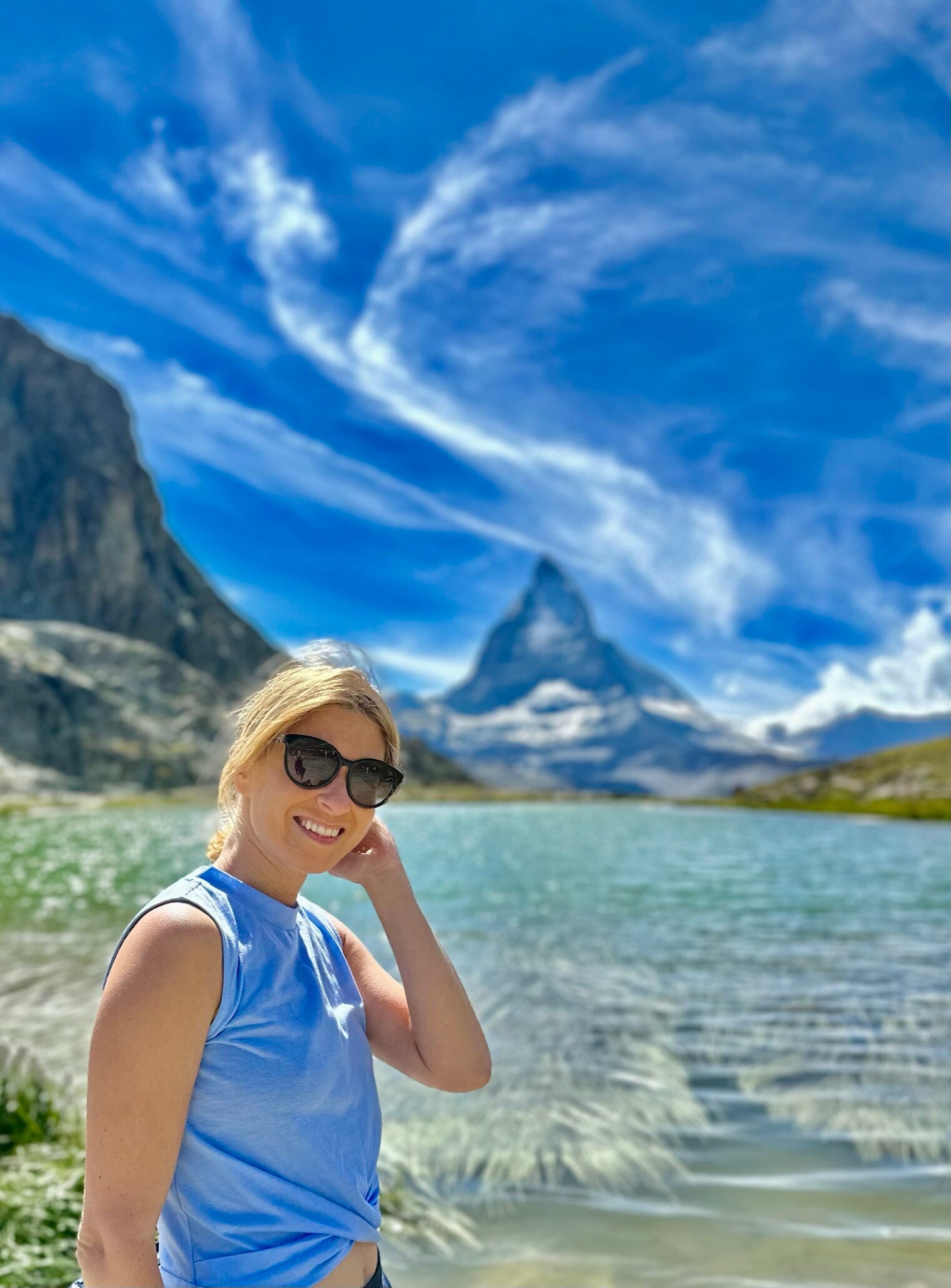
5) Matterhorn
We’re wrapping up this list with a Swiss superstar: the Matterhorn — one of the most photographed peaks on Earth and famously featured on Toblerone chocolate bars*. But forget the wrapper for now — this is your chance to see the real thing up close (chocolate in hand, optional but encouraged). And hey, since you'll be high up in the mountains, there's a good chance it won’t even melt ;)
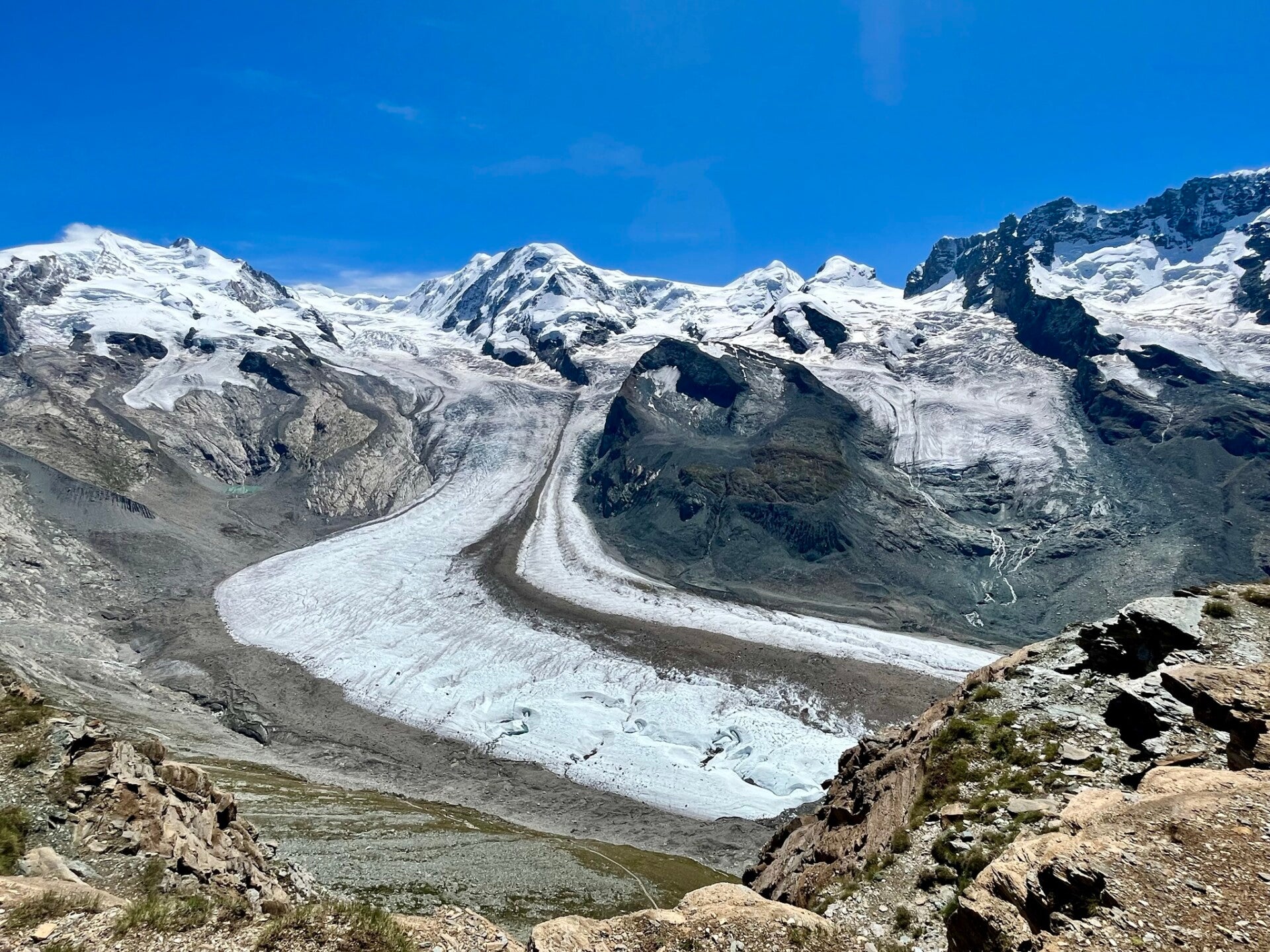
🚠 The adventure begins with a ride on the historic Gornergrat cogwheel train, climbing all the way to nearly 3,100 m. Up top, you're rewarded with a jaw-dropping panorama of glaciers, 4,000-meter peaks, and the mighty Matterhorn in all its jagged glory.
But the real treat? Hiking back down — away from the selfie-stick crowd — along a stunning trail that winds past sapphire-blue alpine lakes, including Riffelsee, which reflects the Matterhorn perfectly on calm days. It's a photographer’s dream and a nature lover’s delight.
This trail is the longest on this list — about 12 km with a downhill slope, taking around 5 hours at a slow pace. If you have sensitive knees, hiking poles might be a smart move. But overall, it’s totally doable with average fitness, and so, so worth it.
While you get amazing Matterhorn views just stepping off the train, hiking is the only way to truly experience its changing angles and moods — and, bonus: you'll escape the peak-time tourist rush.
🛤️ How to Start & End
- Start: 🚉 Gornergrat cogwheel station (departs from Zermatt)
👉 Heads-up: The Gornergrat train is not covered by the SBB Day Pass for public transport — only 50% off with most Swiss passes. - End: Zermatt village (walkable, with cafés and trains waiting below)
🔗 Trail details & map: Gornergrat - Riffelsee-Zermatt
🥾 Alternative Hikes
- Gornergrat to Riffelalp: A slightly shorter version ending at the Riffelalp station, halfway down the mountain.
🔗 Matterhorn- Riffelalp - Gornergrat to Zermatt (via a slightly different route):
🔗 Gornergrat - Zermatt variation
*🍫 Toblerone & the Matterhorn: A Sweet Bit of Trivia
You may have heard that Toblerone had to remove the Matterhorn from its logo in 2023 after outsourcing production abroad — losing its “Swissness” status. But as of 2025, it looks like the brand is reclaiming its Swiss identity, and the iconic peak may be staying put after all.
📖 Read more:
These easy hikes show that you don’t need to tackle steep climbs to enjoy Switzerland’s incredible landscapes. From peaceful lake walks to relaxed mountain trails, each route offers great views with little effort and fewer people around.
Enjoy! :)
Add comment
Comments
Hikes
I would to be in this great netuer but very difficult to get visa .can you advise and help me to get turist visa indeed its have money to cover travel